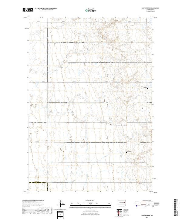
2021 Map of Carpenter NE
USGS Topo · Published 2021About this map
The Coteau des Prairies plateau defines the landscape of this eastern South Dakota quadrangle, where the rolling highlands give rise to several localized drainage systems. Small creeks such as Shue Cr, Pearl Cr, and Redstone Cr meander through the prairie, reflecting the glacial geomorphology of the region. This land, positioned near the border of Clark and Beadle counties, remains primarily defined by its section-line road network and agricultural layout. Local genealogy and history are anchored by two rural burying grounds: Hague Cem in the northeast and Woodland Cem in the southeast. These cemeteries serve as the primary markers of early settlement and community centers in an area characterized by dispersed family farms and expansive grasslands.
Find a feature on this map
24 named features on this map. Tap any name to fly to it.
Don’t see what you’re looking for? This feature index may not catch every label — zoom into the map to look around manually.
Map Details
Editions of this 2021 Carpenter NE Map
This is the sole edition of this map. No revisions or reprints were ever made.
Other maps of this area

1953 · Watertown
USGS Topo · 1:250,000

1958 · Watertown
USGS Topo · 1:250,000
1973 · Staum Dam
USGS Topo · 1:24,000

1973 · Carpenter SE
USGS Topo · 1:24,000

1973 · Willow Lake
USGS Topo · 1:24,000

1973 · Clark South
USGS Topo · 1:24,000
1973 · Carpenter
USGS Topo · 1:24,000
1973 · Willow Lake SW
USGS Topo · 1:24,000
1973 · Raymond SE
USGS Topo · 1:24,000
1973 · Carpenter NE
USGS Topo · 1:24,000