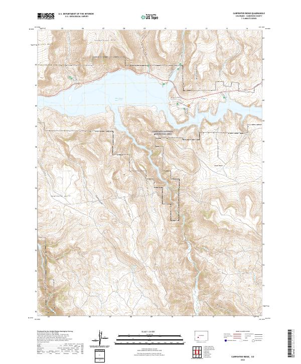
2022 Map of Carpenter Ridge
USGS Topo · Published 2022About this map
Blue Mesa Reservoir dominates the northern portion of this map, its high-altitude waters contained within the deep canyons of the Curecanti National Recreation Area. The landscape is defined by the sharp transition between the massive aquatic feature and the high-desert plateau of Sapinero Mesa. South of the reservoir, the terrain rises into the namesake Carpenter Ridge, where numerous drainages like Fourmile Gulch and Lake Gulch cut through the volcanic geology of the West Elk Mountains.
Find a feature on this map
36 named features on this map. Tap any name to fly to it.
Don’t see what you’re looking for? This feature index may not catch every label — zoom into the map to look around manually.
Map Details
Editions of this 2022 Carpenter Ridge Map
This is the sole edition of this map. No revisions or reprints were ever made.
Other maps of this area

1908 · Uncompahgre
USGS Topo · 1:125,000

1911 · Uncompahgre
USGS Topo · 1:125,000

1954 · Iola
USGS Topo · 1:24,000

1954 · Mc Intosh Mountain
USGS Topo · 1:24,000

1954 · West Elk Peak SW
USGS Topo · 1:24,000

1954 · Little Soap Park
USGS Topo · 1:24,000

1954 · Cebolla
USGS Topo · 1:24,000

1954 · Sapinero
USGS Topo · 1:24,000

1954 · Gateview
USGS Topo · 1:24,000

1956 · Montrose
USGS Topo · 1:250,000