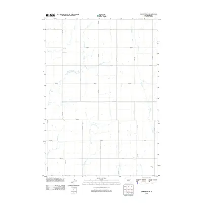
2012 Map of Carpenter SE
USGS Topo · Published 2012About this map
LeSueur Cem serves as a focal point for genealogical interest in this prairie landscape of Kingsbury County. This area of South Dakota is defined by a dendritic network of prairie streams, including Pearl Cr, S Fork Pearl Cr, and Middle Pearl Cr, which weave between a rigid grid of section roads like 420th Ave and 197th St. The mapping captures the agricultural layout of the early 21st century, where the natural watercourses of Shue Cr and Redstone Cr provide the only relief from the geometric precision of the township's land division.
Find a feature on this map
21 named features on this map. Tap any name to fly to it.
Don’t see what you’re looking for? This feature index may not catch every label — zoom into the map to look around manually.
Map Details
Editions of this 2012 Carpenter SE Map
This is the sole edition of this map. No revisions or reprints were ever made.
Other maps of this area

1899 · De Smet
USGS Topo · 1:125,000

1953 · Watertown
USGS Topo · 1:250,000

1958 · Watertown
USGS Topo · 1:250,000

1971 · Bancroft East
USGS Topo · 1:24,000

1971 · Bancroft West
USGS Topo · 1:24,000
1971 · Yale
USGS Topo · 1:24,000
1973 · Staum Dam
USGS Topo · 1:24,000

1973 · Carpenter SE
USGS Topo · 1:24,000

1973 · Willow Lake
USGS Topo · 1:24,000
1973 · Carpenter
USGS Topo · 1:24,000