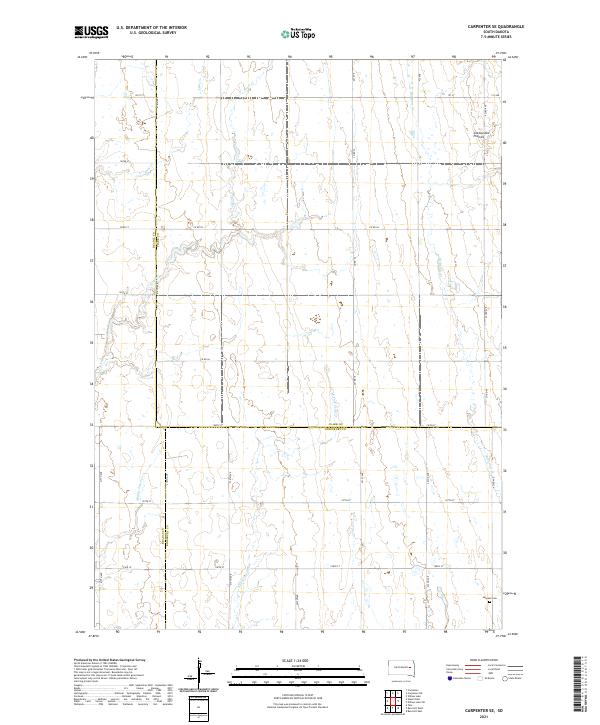
2021 Map of Carpenter SE
USGS Topo · Published 2021About this map
The Coteau des Prairies upland plateau defines the eastern edge of this agricultural landscape in eastern South Dakota. This 2021 survey documents a remote section of the prairie where three counties meet: Beadle, Clark, and Kingsbury. The terrain is shaped by a series of parallel north-south waterways, including Shue Cr, Pearl Cr, Middle Pearl Cr, and S Fork Pearl Cr in the west, while Redstone Cr meanders through the eastern section. For genealogists, the LeSueur Cem in the southeastern corner serves as a primary point of interest, situated along the section lines that organize the rural township grid. The map reveals the strictly rectilinear pattern of local transit, defined by named roads like Co Rd 38 and Co Rd 16 that follow the ancestral Section-Township-Range boundaries.
Find a feature on this map
37 named features on this map. Tap any name to fly to it.
Don’t see what you’re looking for? This feature index may not catch every label — zoom into the map to look around manually.
Map Details
Editions of this 2021 Carpenter SE Map
This is the sole edition of this map. No revisions or reprints were ever made.
Other maps of this area

1899 · De Smet
USGS Topo · 1:125,000

1953 · Watertown
USGS Topo · 1:250,000

1958 · Watertown
USGS Topo · 1:250,000

1971 · Bancroft East
USGS Topo · 1:24,000

1971 · Bancroft West
USGS Topo · 1:24,000
1971 · Yale
USGS Topo · 1:24,000
1973 · Staum Dam
USGS Topo · 1:24,000

1973 · Carpenter SE
USGS Topo · 1:24,000

1973 · Willow Lake
USGS Topo · 1:24,000
1973 · Carpenter
USGS Topo · 1:24,000