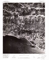
1976 Map of Carpinteria
USGS Topo · Published 1980About this map
Carpinteria and the southern Santa Barbara coastline are captured here in mid-1970s orthophotography, providing a clear aerial perspective of the region's agricultural and suburban transition. The coastal plain is marked by the distinct patterns of orchards and greenhouses south of Summerland, while the dramatic rise of the Santa Ynez Mountains dominates the northern half of the sheet. Unlike standard topographic maps, this imagery reveals the dense canopy of Montecito and the specific textures of the landscape before more recent development intensified. On the northern side of the mountains, the Santa Ynez River carves a rugged path through the interior, contrasting with the expansive Pacific Ocean and the Santa Barbara Channel that define the southern boundary of the map.
Find a feature on this map
6 named features on this map. Tap any name to fly to it.
Don’t see what you’re looking for? This feature index may not catch every label — zoom into the map to look around manually.
Map Details
Editions of this 1976 Carpinteria Map
This is the sole edition of this map. No revisions or reprints were ever made.
Other maps of this area

1902 · Santa Ynez
USGS Topo · 1:125,000

1903 · Mt. Pinos
USGS Topo · 1:125,000

1904 · Ventura
USGS Topo · 1:62,500

1905 · Santa Ynez
USGS Topo · 1:125,000

1941 · Ventura
USGS Topo · 1:62,500

1942 · Little Pine Mountain
USGS Topo · 1:24,000

1943 · Old Man Mountain
USGS Topo · 1:24,000

1943 · Hildreth Peak
USGS Topo · 1:24,000

1944 · Santa Barbara
USGS Topo · 1:31,680
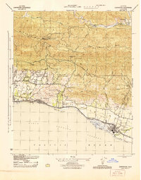
1944 · Carpinteria
USGS Topo · 1:31,680