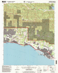
1995 Map of Carpinteria
USGS Topo · Published 2000About this map
The Santa Ynez Mountains dominate the northern half of this coastal landscape, where the Los Padres National Forest meets the Pacific shore. Historically significant land grants like Los Prietos y Najalayegua Grant and El Rincon Grant are clearly delineated, showing the legacy of early California land tenure. Along the coast, the Southern Pacific railroad parallels the shoreline, connecting established communities such as Montecito, Summerland, and Carpinteria. The map captures a mix of coastal agriculture and mid-century development, featuring landmarks like Fleischmann Field and the Carpinteria Cemetery. Inland, the terrain is defined by rugged canyons such as Toro Canyon Creek and water infrastructure including the Juncal Dam and Jameson Lake, which serves the agricultural and residential needs of the Santa Barbara Channel coastal strip.
Find a feature on this map
68 named features on this map. Tap any name to fly to it.
Don’t see what you’re looking for? This feature index may not catch every label — zoom into the map to look around manually.
Map Details
Editions of this 1995 Carpinteria Map
This is the sole edition of this map. No revisions or reprints were ever made.
Other maps of this area
1902 · Santa Ynez
USGS Topo · 1:125,000
1903 · Mt. Pinos
USGS Topo · 1:125,000
1904 · Ventura
USGS Topo · 1:62,500
1905 · Santa Ynez
USGS Topo · 1:125,000
1941 · Ventura
USGS Topo · 1:62,500
1942 · Little Pine Mountain
USGS Topo · 1:24,000
1943 · Old Man Mountain
USGS Topo · 1:24,000
1943 · Hildreth Peak
USGS Topo · 1:24,000
1944 · Santa Barbara
USGS Topo · 1:31,680
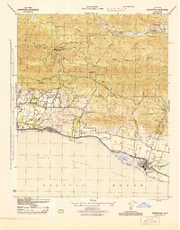
1944 · Carpinteria
USGS Topo · 1:31,680