
1896 Map of Carquinez Strait
USGS Topo · Published 1954About this map
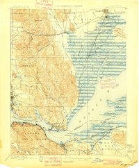
Suisun Bay and the complex tidal network of the Carquinez Strait dominate this late 19th-century landscape, where the confluence of the Sacramento and San Joaquin rivers meets the hills of the Coast Ranges. The industrial and maritime importance of the era is evident in the waterfront developments at Benicia, home to the sprawling U.S. Arsenal at Army Pt., and the neighboring rail-and-port hubs of Vallejo, South Vallejo, and Martinez. Along the southern shore, a string of company towns and shipping points like Crockett, Valona, and Port Chicago line the deepwater channel, supported by the Southern Pacific railroad.
Find a feature on this map
114 named features on this map. Tap any name to fly to it.
Don’t see what you’re looking for? This feature index may not catch every label — zoom into the map to look around manually.
Map Details
Editions of this 1896 Carquinez Strait Map
This is the sole edition of this map. No revisions or reprints were ever made.
Other maps of this area

1895 · San Francisco
USGS Topo · 1:62,500

1896 · Mt. Diablo
USGS Topo · 1:62,500

1897 · Concord
USGS Topo · 1:62,500

1898 · Karquines
USGS Topo · 1:62,500

1898 · Mt. Diablo
USGS Topo · 1:62,500

1899 · San Francisco
USGS Topo · 1:62,500
1901 · Karquines
USGS Topo · 1:62,500

1902 · Napa
USGS Topo · 1:125,000
1907 · Antioch
USGS Topo · 1:62,500
1908 · Vacaville
USGS Topo · 1:62,500