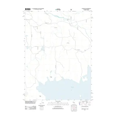
2012 Map of Carr Butte
USGS Topo · Published 2012About this map
Clear Lake Reservoir dominates the southern landscape of this high-altitude basin on the Oregon-California border, serving as a critical water resource for the surrounding high desert. The map captures a sparsely populated region where life revolves around water management and cattle ranching, anchored by the McNeil Ranch and the open range of Walter Flat. Significant elevation markers such as Carr Butte and Cape Horne rise above the flats, while the appropriately named Hopeless Pass and Hopeless Pass Rd suggest the challenges faced by early travelers crossing this terrain. Smaller irrigation and livestock features, including Baker Reservoir and Johnson Reservoir, are scattered throughout, illustrating the complex hydrology of the E Br Lost River drainage system. To the south, the expansive waters of the reservoir reach toward the distinctive landmark of Squatty Butte and the grassy margins of Fiddlers Green.
Find a feature on this map
20 named features on this map. Tap any name to fly to it.
Don’t see what you’re looking for? This feature index may not catch every label — zoom into the map to look around manually.
Map Details
Editions of this 2012 Carr Butte Map
This is the sole edition of this map. No revisions or reprints were ever made.
Other maps of this area

1886 · Modoc Lava Bed
USGS Topo · 1:250,000

1889 · Klamath
USGS Topo · 1:250,000

1892 · Modoc Lava-Bed
USGS Topo · 1:250,000

1894 · Klamath
USGS Topo · 1:250,000

1951 · Clear Lake Reservoir
USGS Topo · 1:62,500

1951 · Tulelake
USGS Topo · 1:62,500

1954 · Alturas
USGS Topo · 1:250,000

1955 · Klamath Falls
USGS Topo · 1:250,000

1957 · Malin
USGS Topo · 1:62,500

1958 · Alturas
USGS Topo · 1:250,000