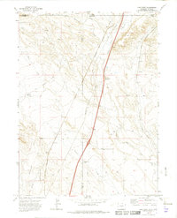
1972 Map of Carr West
USGS Topo · Published 1974About this map
Lone Tree Creek and Spotwood Creek carve through the high plains at the Colorado-Wyoming border in this early 1970s survey. The landscape is defined by its transit corridors, featuring the prominent Union Pacific and Colorado and Southern railroad lines. Evidence of earlier transportation routes persists in the form of an Old Railroad Grade cutting across the northwestern sections. Small settlements and specialized camps such as Norfolk, Warren, and Barton Camp are scattered throughout the quadrangle, alongside industrial markers like a Gravel Pit and several prospects.
Find a feature on this map
31 named features on this map. Tap any name to fly to it.
Don’t see what you’re looking for? This feature index may not catch every label — zoom into the map to look around manually.
Map Details
Editions of this 1972 Carr West Map
3 editions found
Other maps of this area

1905 · Sherman
USGS Topo · 1:125,000

1907 · Livermore
USGS Topo · 1:125,000

1908 · Eaton
USGS Topo · 1:125,000

1909 · Livermore
USGS Topo · 1:125,000

1910 · Eaton
USGS Topo · 1:125,000

1911 · Cheyenne
USGS Topo · 1:125,000

1914 · Cheyenne
USGS Topo · 1:125,000

1950 · Cheyenne
USGS Topo · 1:62,500

1954 · Cheyenne
USGS Topo · 1:250,000

1954 · Greeley
USGS Topo · 1:250,000