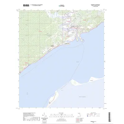
2024 Map of Carrabelle
USGS Topo · Published 2024About this map
Carrabelle sits at the confluence of the Carrabelle River, Crooked River, and New River, serving as a gateway to the Gulf of Mexico. This coastal landscape is defined by its intricate waterways and maritime heritage, featuring the Carrabelle Lighthouse and the strategic Intracoastal Waterway passing through Saint George Sound. To the west, the dense wilderness of Tates Hell Swamp and Tates Hell State Forest dominates the interior, while the barrier landmasses of Saint George Island and Dog Island protect the mainland from the open sea.
Find a feature on this map
71 named features on this map. Tap any name to fly to it.
Don’t see what you’re looking for? This feature index may not catch every label — zoom into the map to look around manually.
Map Details
Editions of this 2024 Carrabelle Map
This is the sole edition of this map. No revisions or reprints were ever made.
Other maps of this area

1943 · Dog Island
USGS Topo · 1:31,680

1943 · Carrabelle
USGS Topo · 1:24,000

1944 · Pickett Bay
USGS Topo · 1:31,680

1944 · Carrabelle
USGS Topo · 1:31,680

1944 · Green Point
USGS Topo · 1:31,680

1944 · Sugar Hill
USGS Topo · 1:31,680

1945 · Tates Hell Swamp
USGS Topo · 1:31,680

1945 · Mc Intyre
USGS Topo · 1:31,680

1945 · Sugar Hill
USGS Topo · 1:31,680

1945 · Pickett Bay
USGS Topo · 1:31,680