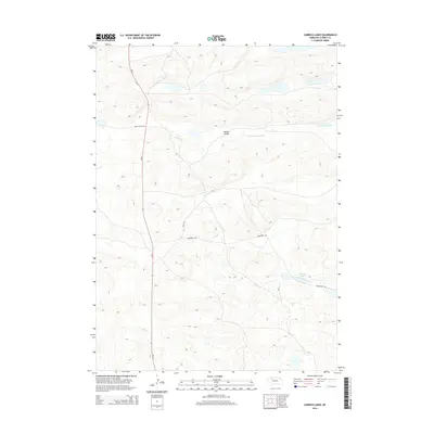
2014 Map of Carrico Lakes
USGS Topo · Published 2014About this map
The North Loup River meanders through the northern reaches of this Cherry County landscape, a region defined by its complex hydrology and the broad depression of Survey Valley. This 2014 survey documents the remote character of north-central Nebraska, where water is the primary geographic anchor. In the southeastern portion of the quadrangle, the Carrico Lakes sit amidst the interdunal swales typical of the Sandhills. The infrastructure is sparse, dominated by the north-south corridor of Ne-61, which provides the main transit link through the area. Local access is maintained through a network of rural routes including Survey Valley Rd, Hoyt Dr, and Henderson Rd, which serve the scattered ranching interests that characterize this section of the Nebraska interior.
Find a feature on this map
8 named features on this map. Tap any name to fly to it.
Don’t see what you’re looking for? This feature index may not catch every label — zoom into the map to look around manually.
Map Details
Editions of this 2014 Carrico Lakes Map
This is the sole edition of this map. No revisions or reprints were ever made.
Other maps of this area

1948 · Ashby
USGS Topo · 1:62,500

1948 · Whitman
USGS Topo · 1:62,500

1949 · Ashby
USGS Topo · 1:62,500

1949 · Steverson Lake
USGS Topo · 1:62,500

1949 · Turpin Lake
USGS Topo · 1:62,500

1950 · Whitman
USGS Topo · 1:62,500

1951 · Steverson Lake
USGS Topo · 1:62,500

1951 · Turpin Lake
USGS Topo · 1:62,500

1957 · Valentine
USGS Topo · 1:250,000

1959 · Valentine
USGS Topo · 1:250,000