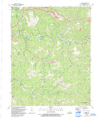
1992 Map of Carrie
USGS Topo · Published 1992About this map
Troublesome Creek carves a winding path through the heart of this East Kentucky landscape, dictating the placement of historic settlements like Carrie and Emmalena. During the early 1990s, the region's topography remained defined by its narrow hollows and high ridges, including Bearville Ridge and Ash Bee Tree Gap. The map documents a community infrastructure built around local institutions, such as the Lotts Creek Community Sch and numerous small houses of worship including Maggie Mem Ch and New Bethlehem Ch. The economic character of the area is visibly marked by several Strip Mine operations scattered across the higher elevations, while the lower southeast corner highlights the Carr Fork Lake State Wildlife Mgmt Area. This survey is particularly useful for genealogists tracing family names through the many scattered Cem (cemetery) labels and small branches like Youngs Fork and Lottis Creek.
Find a feature on this map
65 named features on this map. Tap any name to fly to it.
Don’t see what you’re looking for? This feature index may not catch every label — zoom into the map to look around manually.
Map Details
Editions of this 1992 Carrie Map
This is the sole edition of this map. No revisions or reprints were ever made.
Other maps of this area

1890 · Whitesburg
USGS Topo · 1:125,000

1891 · Hazard
USGS Topo · 1:125,000

1892 · Whitesburg
USGS Topo · 1:125,000

1912 · Hindman
USGS Topo · 1:48,000

1913 · Oven Fork
USGS Topo · 1:48,000

1914 · Troublesome
USGS Topo · 1:62,500

1915 · Hindman
USGS Topo · 1:62,500

1915 · Whitesburg
USGS Topo · 1:62,500

1916 · Cornettsville
USGS Topo · 1:62,500

1954 · Noble
USGS Topo · 1:24,000