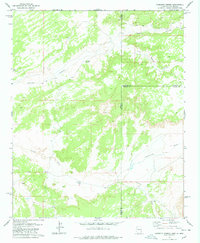
1978 Map of Carrisito Spring
USGS Topo · Published 1978About this map
Carrisito Spring sits at the heart of this high-desert landscape where the borders of Arizona and New Mexico meet. The terrain is defined by a complex drainage system, primarily the winding path of Carrizo Wash and the prominent Blanco Canyon to the north. These ephemeral waterways, including Twentytwo Wash and Little Blanco Canyon, shaped the local movement and land use in a region where water was the primary concern for survival and livestock management.
Find a feature on this map
19 named features on this map. Tap any name to fly to it.
Don’t see what you’re looking for? This feature index may not catch every label — zoom into the map to look around manually.
Map Details
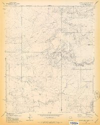
Editions of this 1978 Carrisito Spring Map
2 editions found
Other maps of this area

1886 · St Johns
USGS Topo · 1:250,000

1892 · St Johns
USGS Topo · 1:250,000

1954 · Saint Johns
USGS Topo · 1:250,000

1957 · Saint Johns
USGS Topo · 1:250,000

1958 · Saint Johns
USGS Topo · 1:250,000

1962 · Saint Johns
USGS Topo · 1:250,000

1971 · Mesa Parada NW
USGS Topo · 1:24,000

1971 · Mesa Parada
USGS Topo · 1:24,000

1972 · Twentytwo Spring
USGS Topo · 1:24,000

1972 · Cantaralo Spring
USGS Topo · 1:24,000