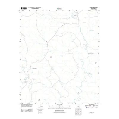
2011 Map of Carrizo
USGS Topo · Published 2011About this map
Carrizo anchors the northeastern corner of this landscape in eastern Arizona, situated where the terrain transitions into a complex network of canyons and high ridges. The area is defined by its water management history, evidenced by a high density of tanks such as John Moore Tank, Peach Tree Tank, and Mud Cat Tank, which support cattle ranching in an arid environment. The map details the rugged topography surrounding Squaw Dress Ridge and Ragged Top Mountain, while natural drainages like Carrizo Creek and Water Trough Canyon carve through the limestone-rich earth.
Find a feature on this map
41 named features on this map. Tap any name to fly to it.
Don’t see what you’re looking for? This feature index may not catch every label — zoom into the map to look around manually.
Map Details
Editions of this 2011 Carrizo Map
This is the sole edition of this map. No revisions or reprints were ever made.
Other maps of this area

1886 · Holbrook
USGS Topo · 1:250,000

1893 · Holbrook
USGS Topo · 1:250,000

1954 · Holbrook
USGS Topo · 1:250,000

1954 · Mesa
USGS Topo · 1:250,000

1957 · Mesa
USGS Topo · 1:250,000

1957 · Holbrook
USGS Topo · 1:250,000

1958 · Mesa
USGS Topo · 1:250,000

1958 · Holbrook
USGS Topo · 1:250,000

1960 · Holbrook
USGS Topo · 1:250,000

1960 · Mesa
USGS Topo · 1:250,000