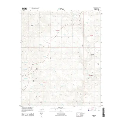
2014 Map of Carrizo
USGS Topo · Published 2014About this map
Carrizo stands near the northern edge of this high-desert landscape, situated where Us-60 winds through the complex topography of Gila County. The terrain is defined by a series of prominent elevations and deep incisions, including the massive Cibecue Ridge to the northwest and the distinctive Ragged Top Mtn to the west. This 2014 survey documents a land managed through numerous water improvements, visible in the high density of named tanks such as Mud Cat Tank, Wild Steer Tank, and Javelina Tank. These features, along with several springs like A Ninetysix Spring and Limestone Spring, highlight the essential infrastructure for ranching in this arid environment. The map also traces the winding course of Carrizo Creek as it cuts south toward Bat Canyon, illustrating the natural drainage patterns that have shaped the local geography between Wild Dove Butte and Cow Pasture Butte.
Find a feature on this map
46 named features on this map. Tap any name to fly to it.
Don’t see what you’re looking for? This feature index may not catch every label — zoom into the map to look around manually.
Map Details
Editions of this 2014 Carrizo Map
This is the sole edition of this map. No revisions or reprints were ever made.
Other maps of this area

1886 · Holbrook
USGS Topo · 1:250,000

1893 · Holbrook
USGS Topo · 1:250,000

1954 · Holbrook
USGS Topo · 1:250,000

1954 · Mesa
USGS Topo · 1:250,000

1957 · Mesa
USGS Topo · 1:250,000

1957 · Holbrook
USGS Topo · 1:250,000

1958 · Mesa
USGS Topo · 1:250,000

1958 · Holbrook
USGS Topo · 1:250,000

1960 · Holbrook
USGS Topo · 1:250,000

1960 · Mesa
USGS Topo · 1:250,000