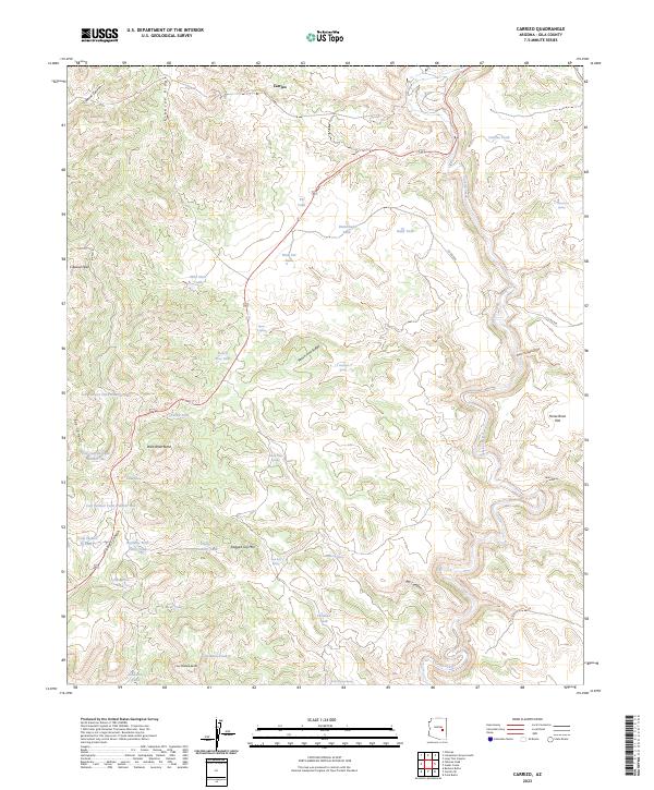
2023 Map of Carrizo
USGS Topo · Published 2023About this map
Carrizo occupies the northern edge of this high-elevation landscape, where a sophisticated network of water infrastructure supports life in a region defined by complex canyon systems and dramatic ridges. The terrain is marked by significant vertical relief, from the depths of Cibecue Canyon to the heights of Cibecue Peak and Ragged Top Mtn. To the east, Carrizo Creek winds through the topography, flanked by landmarks like Horse Bone Flat and Red Canyon. This survey illustrates a modern reliance on specialized water catchments, as evidenced by the numerous named tanks such as Wild Steer Tank, Mud Cat Tank, and Javelina Tank distributed across the plateaus. Transportation is limited to a few arterial routes like Bia RD 12 and Co RD 818, emphasizing the area's transition between isolated ridges like Peach Tree Ridge and prominent formations such as Wild Dove Butte.
Find a feature on this map
48 named features on this map. Tap any name to fly to it.
Don’t see what you’re looking for? This feature index may not catch every label — zoom into the map to look around manually.
Map Details
Editions of this 2023 Carrizo Map
This is the sole edition of this map. No revisions or reprints were ever made.
Other maps of this area

1886 · Holbrook
USGS Topo · 1:250,000

1893 · Holbrook
USGS Topo · 1:250,000

1954 · Holbrook
USGS Topo · 1:250,000

1954 · Mesa
USGS Topo · 1:250,000

1957 · Mesa
USGS Topo · 1:250,000

1957 · Holbrook
USGS Topo · 1:250,000

1958 · Mesa
USGS Topo · 1:250,000

1958 · Holbrook
USGS Topo · 1:250,000

1960 · Holbrook
USGS Topo · 1:250,000

1960 · Mesa
USGS Topo · 1:250,000