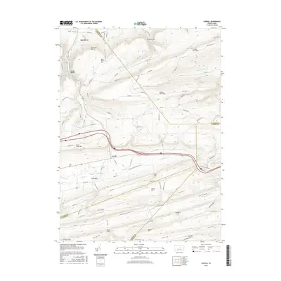
2016 Map of Carroll
USGS Topo · Published 2016About this map
Sugar Valley forms the heart of this central Pennsylvania landscape, where the settlements of Carroll and Eastville lie nestled between prominent mountain ridges. This 2016 survey illustrates the complex geography of the region, defined by the parallel rise of Nippenose Mtn to the north and Nittany Mtn to the south. The area is a significant hydrological crossroads where Fishing Cr and White Deer Hole Cr originate near the borders of Lycoming, Clinton, Union, and Centre counties.
Find a feature on this map
93 named features on this map. Tap any name to fly to it.
Don’t see what you’re looking for? This feature index may not catch every label — zoom into the map to look around manually.
Map Details
Editions of this 2016 Carroll Map
This is the sole edition of this map. No revisions or reprints were ever made.
Other maps of this area

1921 · Williamsport
USGS Topo · 1:48,000

1921 · Lock Haven
USGS Topo · 1:62,500

1923 · Lock Haven
USGS Topo · 1:62,500

1923 · Williamsport
USGS Topo · 1:62,500

1937 · Millheim
USGS Topo · 1:48,000

1938 · Mifflinburg
USGS Topo · 1:48,000

1941 · Millheim
USGS Topo · 1:62,500

1943 · Mifflinburg
USGS Topo · 1:62,500

1944 · Williamsport
USGS Topo · 1:62,500

1944 · Lock Haven
USGS Topo · 1:62,500
Featured Places
- Hartley Township, PA
- Washington Township, PA
- Carroll, Greene Township
- Castle Rocks, Crawford Township
- Crawford Township, PA