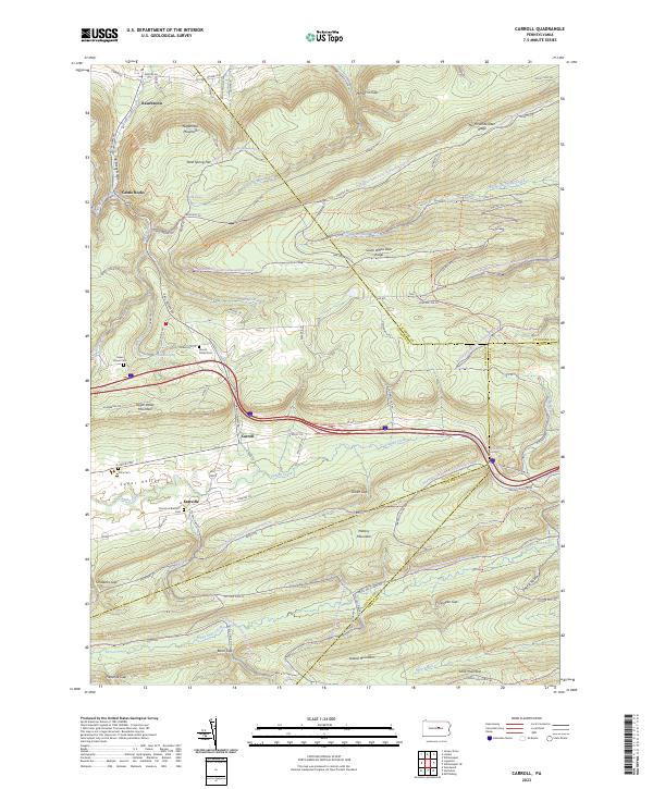
2023 Map of Carroll
USGS Topo · Published 2023About this map
Carroll and the neighboring settlement of Eastville sit within the high-altitude cradle of Sugar Valley, a landscape defined by the parallel ridges of the central Pennsylvania mountains. This 2023 survey illustrates the enduring rural character of the region, where the Church of Brethren Cem and Mount Union Cem mark the heritage of local families. The terrain is a series of dramatic gaps and ridges, with water flowing through Fishing Creek and the headwaters of White Deer Hole Creek. The map shows a region heavily integrated with public lands, as evidenced by the extensive network of the Tiadaghton State Forest Snowmobile Trails Trl and the Bald Eagle State Forest Snowmobile Trails Trl that crisscross Nippenose Mountain and North White Deer Ridge. This contemporary record captures the intersection of forestry, recreation, and small-town settlement in the Appalachian interior.
Find a feature on this map
60 named features on this map. Tap any name to fly to it.
Don’t see what you’re looking for? This feature index may not catch every label — zoom into the map to look around manually.
Map Details
Editions of this 2023 Carroll Map
This is the sole edition of this map. No revisions or reprints were ever made.
Other maps of this area

1921 · Williamsport
USGS Topo · 1:48,000

1921 · Lock Haven
USGS Topo · 1:62,500

1923 · Lock Haven
USGS Topo · 1:62,500

1923 · Williamsport
USGS Topo · 1:62,500

1937 · Millheim
USGS Topo · 1:48,000

1938 · Mifflinburg
USGS Topo · 1:48,000

1941 · Millheim
USGS Topo · 1:62,500

1943 · Mifflinburg
USGS Topo · 1:62,500

1944 · Williamsport
USGS Topo · 1:62,500

1944 · Lock Haven
USGS Topo · 1:62,500
Featured Places
- Hartley Township, PA
- Washington Township, PA
- Limestone Township, PA
- Miles Township, PA
- Shakespeare Club, PA