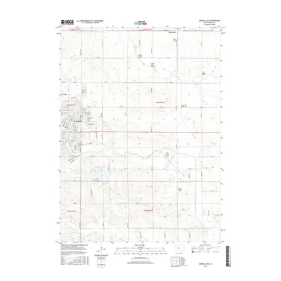
2015 Map of Carroll East
USGS Topo · Published 2015About this map
The city of Carroll and the neighboring community of Lidderdale anchor this 2015 survey of central Iowa's agricultural landscape. The eastern outskirts of the county seat reveal a complex grid of residential streets and arterial roads like Mahogany Ave and E Anthony St, while the Carroll City Cem provides a significant touchstone for genealogical research in the area. The terrain is defined by the winding course of the Middle Raccoon River and the waters of Swan Lake, which interrupt the surrounding farmland.
Find a feature on this map
63 named features on this map. Tap any name to fly to it.
Don’t see what you’re looking for? This feature index may not catch every label — zoom into the map to look around manually.
Map Details
Editions of this 2015 Carroll East Map
This is the sole edition of this map. No revisions or reprints were ever made.
Other maps of this area

1954 · Omaha
USGS Topo · 1:250,000

1954 · Fort Dodge
USGS Topo · 1:250,000

1957 · Omaha
USGS Topo · 1:250,000

1957 · Fort Dodge
USGS Topo · 1:250,000

1958 · Omaha
USGS Topo · 1:250,000

1958 · Fort Dodge
USGS Topo · 1:250,000

1971 · Dedham
USGS Topo · 1:24,000

1971 · Coon Rapids North
USGS Topo · 1:24,000

1971 · Templeton
USGS Topo · 1:24,000
1980 · Glidden
USGS Topo · 1:24,000