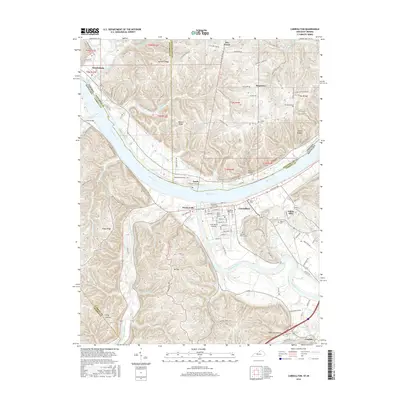
2016 Map of Carrollton
USGS Topo · Published 2016About this map
The confluence of the Ohio River and the Kentucky River anchors this study of the borderlands between Kentucky and Indiana. In Carroll County, the city of Carrollton serves as a dense hub of activity, with its historic street grid featuring Main St, Sycamore St, and Seminary St. The map details numerous burial sites that reflect the area's deep family roots, including the Methodist Church Cem, Saint John's Cem, and the expansive Carrollton IOOF Cem. Across the water, smaller settlements like Lamb and Prestonville sit along the riverbanks, while the Indiana side near Brooksburg is defined by the winding path of Indian Kentucky Creek.
Find a feature on this map
115 named features on this map. Tap any name to fly to it.
Don’t see what you’re looking for? This feature index may not catch every label — zoom into the map to look around manually.
Map Details
Editions of this 2016 Carrollton Map
This is the sole edition of this map. No revisions or reprints were ever made.
Other maps of this area

1943 · Vevay North
USGS Topo · 1:24,000

1943 · Brooksburg
USGS Topo · 1:24,000

1943 · Vevay South
USGS Topo · 1:24,000

1952 · Vevay South
USGS Topo · 1:24,000

1952 · Worthville
USGS Topo · 1:24,000

1952 · Campbellsburg
USGS Topo · 1:24,000

1953 · Bedford
USGS Topo · 1:24,000

1953 · Carrollton
USGS Topo · 1:24,000

1953 · Madison East
USGS Topo · 1:24,000

1956 · Bennington
USGS Topo · 1:24,000