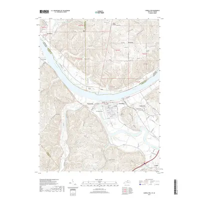
2019 Map of Carrollton
USGS Topo · Published 2019About this map
Carrollton sits at the vital confluence where the Kentucky River meets the Ohio River, serving as a historic river terminal and county seat. This 2019 survey illustrates the dense settlement pattern of the town and nearby Prestonville, contrasted with the ridgeline communities of Indian Hills and English further south. The landscape is defined by its massive river bends and the steep drainages that feed them, including Locust Creek and the Little Kentucky River.
Find a feature on this map
121 named features on this map. Tap any name to fly to it.
Don’t see what you’re looking for? This feature index may not catch every label — zoom into the map to look around manually.
Map Details
Editions of this 2019 Carrollton Map
This is the sole edition of this map. No revisions or reprints were ever made.
Other maps of this area

1943 · Vevay North
USGS Topo · 1:24,000

1943 · Brooksburg
USGS Topo · 1:24,000

1943 · Vevay South
USGS Topo · 1:24,000

1952 · Vevay South
USGS Topo · 1:24,000

1952 · Worthville
USGS Topo · 1:24,000

1952 · Campbellsburg
USGS Topo · 1:24,000

1953 · Bedford
USGS Topo · 1:24,000

1953 · Carrollton
USGS Topo · 1:24,000

1953 · Madison East
USGS Topo · 1:24,000

1956 · Bennington
USGS Topo · 1:24,000