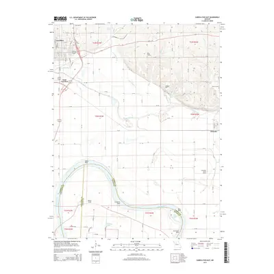
2015 Map of Carrollton East
USGS Topo · Published 2015About this map
Carrollton and its southern outskirts define the northwestern portion of this Missouri landscape, where the town's street grid meets the winding course of Wakenda Creek. The terrain transitions from the developed corridors along Us-24 BR E down into the fertile bottomlands of the Missouri River valley. This waterway dominates the southern half of the map, characterized by sharp river bends such as Bakers Bend, Cranberry Bend, and Hills Bend.
Find a feature on this map
131 named features on this map. Tap any name to fly to it.
Don’t see what you’re looking for? This feature index may not catch every label — zoom into the map to look around manually.
Map Details
Editions of this 2015 Carrollton East Map
This is the sole edition of this map. No revisions or reprints were ever made.
Other maps of this area

1889 · Lexington
USGS Topo · 1:125,000

1890 · Marshall
USGS Topo · 1:125,000

1892 · Marshall
USGS Topo · 1:125,000

1901 · Marshall
USGS Topo · 1:125,000

1951 · Bosworth
USGS Topo · 1:24,000

1951 · Miami Station
USGS Topo · 1:24,000

1951 · Carrollton East
USGS Topo · 1:24,000
1951 · Standish
USGS Topo · 1:24,000

1951 · Waverly
USGS Topo · 1:24,000

1953 · Moberly
USGS Topo · 1:250,000