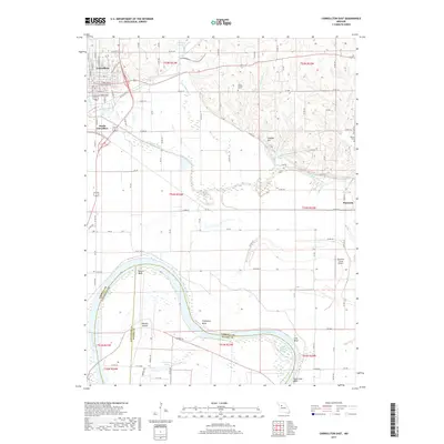
2017 Map of Carrollton East
USGS Topo · Published 2017About this map
Carrollton serves as the focal point of this region, where the street grid of the town proper gives way to the open agricultural lands of Carroll County. Southward from the intersection of Old US Hwy 65 and Old US Hwy 24, the landscape is defined by the winding course of Wakenda Creek and its many tributaries, including Little Wakenda Cr and Standley Br. The map documents a rural transition between the upland settlements and the lower bottomlands approaching the great river.
Find a feature on this map
52 named features on this map. Tap any name to fly to it.
Don’t see what you’re looking for? This feature index may not catch every label — zoom into the map to look around manually.
Map Details
Editions of this 2017 Carrollton East Map
This is the sole edition of this map. No revisions or reprints were ever made.
Other maps of this area

1889 · Lexington
USGS Topo · 1:125,000

1890 · Marshall
USGS Topo · 1:125,000

1892 · Marshall
USGS Topo · 1:125,000

1901 · Marshall
USGS Topo · 1:125,000

1951 · Bosworth
USGS Topo · 1:24,000

1951 · Miami Station
USGS Topo · 1:24,000

1951 · Carrollton East
USGS Topo · 1:24,000
1951 · Standish
USGS Topo · 1:24,000

1951 · Waverly
USGS Topo · 1:24,000

1953 · Moberly
USGS Topo · 1:250,000