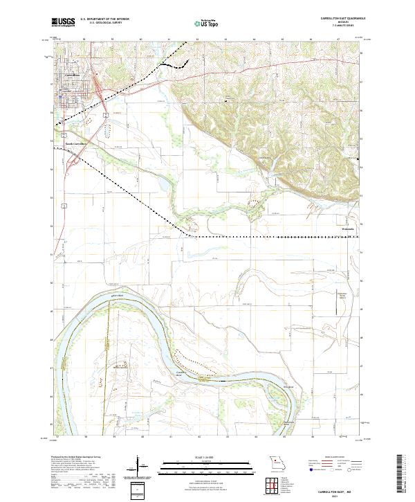
2021 Map of Carrollton East
USGS Topo · Published 2021About this map
The Carroll County Courthouse stands as a central landmark in the town of Carrollton, anchoring a street grid that includes N Main St and E Benton St. This agricultural and riverine landscape is defined by the sweeping curves of the Missouri River, which creates distinctive geographical features like Bakers Bend and Cranberry Bend. The river's influence on the terrain is further evidenced by secondary channels such as Hills Island Chute and Cranberry Chute, separating named landmasses like Whites Island from the mainland. To the north, the smaller Wakenda Creek and its tributary Little Wakenda Cr wind through the hills near Shields Hill, illustrating the complex drainage patterns of the region. Local history is preserved in the placement of Willis Chapel Cem and Adkins Cem, while the modern transportation network is represented by Famuliner Farms Airport and the transition from Old US Hwy 24 to the village of Wakenda.
Find a feature on this map
49 named features on this map. Tap any name to fly to it.
Don’t see what you’re looking for? This feature index may not catch every label — zoom into the map to look around manually.
Map Details
Editions of this 2021 Carrollton East Map
This is the sole edition of this map. No revisions or reprints were ever made.
Other maps of this area

1889 · Lexington
USGS Topo · 1:125,000

1890 · Marshall
USGS Topo · 1:125,000

1892 · Marshall
USGS Topo · 1:125,000

1901 · Marshall
USGS Topo · 1:125,000

1951 · Bosworth
USGS Topo · 1:24,000

1951 · Miami Station
USGS Topo · 1:24,000

1951 · Carrollton East
USGS Topo · 1:24,000
1951 · Standish
USGS Topo · 1:24,000

1951 · Waverly
USGS Topo · 1:24,000

1953 · Moberly
USGS Topo · 1:250,000