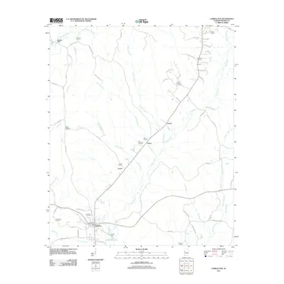
2011 Map of Carrollton
USGS Topo · Published 2011About this map
Carrollton serves as the primary hub of this west Alabama landscape, where the Carrollton Post Office and local streets anchor the community. The surrounding countryside is defined by the winding course of Lubbub Creek and its many tributaries, including Stration Branch and Johnsons Branch. This 2011 survey reveals a high density of rural burial grounds, such as Union Hill Cemetery, Old Sardis Cemetery, and Windle Cemetery, providing significant data for genealogical research. The geography transitions from the residential blocks of the town center to the dispersed settlements of Stansel, Owens, and Carloss. Small-scale water management is evident at Kilpatrick Lake and Parson Dam, while the presence of Beards Mill in the northwest suggests the area’s long-standing reliance on local creek-side industry. The network of county roads, including Co HWY-37 and Co RD-12, connects these disparate hamlets across a terrain of dense wooded branches and small agricultural clearings.
Find a feature on this map
71 named features on this map. Tap any name to fly to it.
Don’t see what you’re looking for? This feature index may not catch every label — zoom into the map to look around manually.
Map Details
Editions of this 2011 Carrollton Map
This is the sole edition of this map. No revisions or reprints were ever made.
Other maps of this area

1953 · Birmingham
USGS Topo · 1:250,000

1953 · West Point
USGS Topo · 1:250,000

1956 · Birmingham
USGS Topo · 1:250,000

1957 · Birmingham
USGS Topo · 1:250,000

1958 · West Point
USGS Topo · 1:250,000

1963 · West Point
USGS Topo · 1:250,000

1966 · Ethelsville
USGS Topo · 1:24,000

1966 · Reform SW
USGS Topo · 1:24,000

1967 · Carrollton
USGS Topo · 1:24,000

1967 · Gordo
USGS Topo · 1:24,000