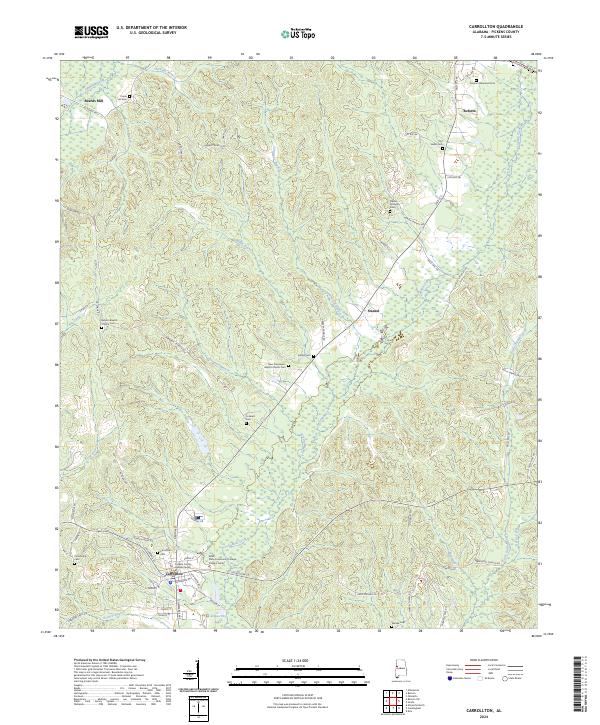
2024 Map of Carrollton
USGS Topo · Published 2024About this map
Carrollton serves as the focal point of this Pickens County landscape, anchored by the Pickens County Judicial Center and the Bevill State Community College Pickens Center. The settlement pattern follows the local drainage systems, with the ATN Railroad cutting a path through the terrain near Reform in the north and through Carrollton in the south. The area is dense with sites of genealogical interest, including the Carrollton Cem, Graham Memorial Cem, and Old Sardis Cem.
Find a feature on this map
83 named features on this map. Tap any name to fly to it.
Don’t see what you’re looking for? This feature index may not catch every label — zoom into the map to look around manually.
Map Details
Editions of this 2024 Carrollton Map
This is the sole edition of this map. No revisions or reprints were ever made.
Other maps of this area

1953 · Birmingham
USGS Topo · 1:250,000

1953 · West Point
USGS Topo · 1:250,000

1956 · Birmingham
USGS Topo · 1:250,000

1957 · Birmingham
USGS Topo · 1:250,000

1958 · West Point
USGS Topo · 1:250,000

1963 · West Point
USGS Topo · 1:250,000

1966 · Ethelsville
USGS Topo · 1:24,000

1966 · Reform SW
USGS Topo · 1:24,000

1967 · Carrollton
USGS Topo · 1:24,000

1967 · Gordo
USGS Topo · 1:24,000