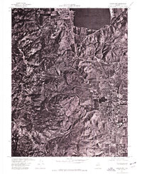
1974 Map of Carson City
USGS Topo · Published 1977About this map
Eagle Valley serves as the geographic heart of this orthophotoquad, showing the Nevada state capital during a period of mid-1970s expansion. Produced from aerial photography taken on Independence Day in 1974, the imagery provides a clear view of the urban grid of Carson City as it meets the rising slopes of the Carson Range to the west. To the north, the waters of Washoe Lake dominate the landscape, framed by the rugged foothills of the Virginia Range. This unique visual document, created in cooperation with the U.S. Soil Conservation Service, uses photographic detail rather than standard topographic lines to illustrate the proximity of the capital city to the surrounding desert and mountain terrain, revealing the precise footprint of development at a time when the region's population was beginning to climb.
Find a feature on this map
5 named features on this map. Tap any name to fly to it.
Don’t see what you’re looking for? This feature index may not catch every label — zoom into the map to look around manually.
Map Details
Editions of this 1974 Carson City Map
This is the sole edition of this map. No revisions or reprints were ever made.
Other maps of this area

1891 · Carson
USGS Topo · 1:125,000

1893 · Carson
USGS Topo · 1:125,000

1950 · Virginia City
USGS Topo · 1:62,500

1950 · Mt. Rose
USGS Topo · 1:62,500

1952 · Mt. Rose
USGS Topo · 1:62,500

1952 · Virginia City
USGS Topo · 1:62,500

1955 · Marlette Lake
USGS Topo · 1:24,000

1955 · Glenbrook
USGS Topo · 1:24,000

1956 · Dayton
USGS Topo · 1:62,500

1956 · Carson City
USGS Topo · 1:62,500