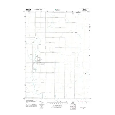
2011 Map of Carson City
USGS Topo · Published 2011About this map
Carson City serves as the primary hub of activity in this 2011 survey, situated along the banks of Fish Creek. The community is well-established, featuring the Carson City Post Office and multiple burial grounds including the Carson City Cemetery and Saint Marys Cemetery. North of the main settlement, the Mill Pond indicates a history of local water management, while the United Brethren Church Camp and Red Pines Campground suggest a landscape valued for community gathering and recreation. The surrounding terrain is defined by a rigid grid of agricultural roads, such as W County Line Rd and S Mount Hope Rd, which connect smaller outlying settlements like New Haven Center, Sethton, and Brice. These rural junctions often center on small landmarks like the New Haven Center Cemetery, reflecting the enduring genealogical and social fabric of this Michigan countryside.
Find a feature on this map
61 named features on this map. Tap any name to fly to it.
Don’t see what you’re looking for? This feature index may not catch every label — zoom into the map to look around manually.
Map Details
Editions of this 2011 Carson City Map
This is the sole edition of this map. No revisions or reprints were ever made.
Other maps of this area

1918 · Perrinton
USGS Topo · 1:62,500

1935 · Alma
USGS Topo · 1:62,500

1938 · Alma
USGS Topo · 1:62,500

1943 · Perrinton
USGS Topo · 1:62,500

1954 · Midland
USGS Topo · 1:250,000

1958 · Midland
USGS Topo · 1:250,000

1959 · Midland
USGS Topo · 1:250,000

1965 · Sumner
USGS Topo · 1:24,000
1965 · Perrinton
USGS Topo · 1:24,000

1965 · Crystal
USGS Topo · 1:24,000