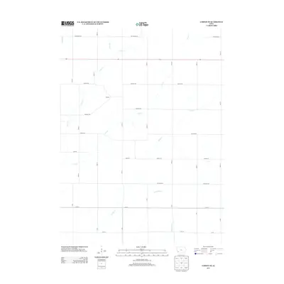
2013 Map of Carson NE
USGS Topo · Published 2013About this map
Wheeler stands as a focal point in this portion of Pottawattamie County, situated amidst a landscape defined by an intricate network of waterways. The terrain is carved by numerous drainage systems, including Farm Cr and the winding course of Jordan Cr. These streams dictate the agricultural layout of the region, where a rigid grid of rural roads such as Pioneer Trl and Cottonwood Rd intersects the natural flow of the land. Route 92 serves as the primary east-west corridor, cutting through the northern section of the map and connecting these disparate rural homesteads. The naming conventions for the roads, often utilizing tree species like Basswood Rd and Applewood Rd, suggest a long-standing local connection to the prairie-timber border environment. Genealogists and local historians can use the specific placement of these named roads and watercourses, such as Little Indian Cr and Crabapple Cr, to pinpoint ancestral landholdings and rural farmsteads in the early 21st century.
Find a feature on this map
36 named features on this map. Tap any name to fly to it.
Don’t see what you’re looking for? This feature index may not catch every label — zoom into the map to look around manually.
Map Details
Editions of this 2013 Carson NE Map
This is the sole edition of this map. No revisions or reprints were ever made.
Other maps of this area

1954 · Omaha
USGS Topo · 1:250,000

1957 · Omaha
USGS Topo · 1:250,000

1958 · Omaha
USGS Topo · 1:250,000

1963 · Avoca SE
USGS Topo · 1:24,000

1963 · Oakland
USGS Topo · 1:24,000

1971 · Atlantic SW
USGS Topo · 1:24,000

1978 · Carson
USGS Topo · 1:24,000

1978 · Griswold
USGS Topo · 1:24,000
1978 · Emerson
USGS Topo · 1:24,000

1978 · Wales
USGS Topo · 1:24,000