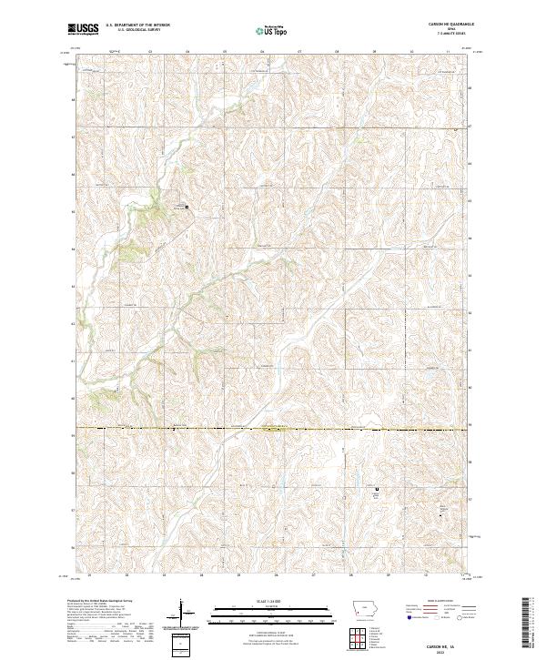
2022 Map of Carson NE
USGS Topo · Published 2022About this map
Wheeler Grove Cem and Buckner Cem sit among the rolling drainage divides of the Pottawattamie and Montgomery county line. This landscape is defined by its dense network of seasonal and perennial streams, including the southward-flowing Jordan Cr, Indian Cr, and Little Indian Cr. The section-line road grid, which includes long stretches of Pioneer Trl, Beechnut Rd, and Applewood Rd, anchors the agricultural character of this corner of Iowa. Small, established burying grounds like Center Ridge Cem and Elliot Hillside Cem provide essential anchor points for genealogists tracing early families in this rural corridor between the townships of T73N and T75N.
Find a feature on this map
28 named features on this map. Tap any name to fly to it.
Don’t see what you’re looking for? This feature index may not catch every label — zoom into the map to look around manually.
Map Details
Editions of this 2022 Carson NE Map
This is the sole edition of this map. No revisions or reprints were ever made.
Other maps of this area

1954 · Omaha
USGS Topo · 1:250,000

1957 · Omaha
USGS Topo · 1:250,000

1958 · Omaha
USGS Topo · 1:250,000

1963 · Avoca SE
USGS Topo · 1:24,000

1963 · Oakland
USGS Topo · 1:24,000

1971 · Atlantic SW
USGS Topo · 1:24,000

1978 · Carson
USGS Topo · 1:24,000

1978 · Griswold
USGS Topo · 1:24,000
1978 · Emerson
USGS Topo · 1:24,000

1978 · Wales
USGS Topo · 1:24,000