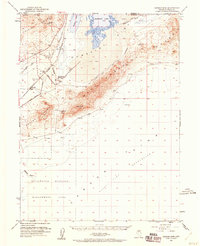
1951 Map of Carson Sink
USGS Topo · Published 1960About this map
The West Humboldt Range and the Trinity Range frame a stark desert landscape where the Humboldt River terminates into the Humboldt Lake and the vast Carson Sink. By the early 1950s, the remnants of historical westward migration were still clearly etched across the basin floor, with the Old California Trail Road and Old Central Road threading through the alkali flats. Settlement is sparse, represented by small railroad-adjacent points like Miriam and Ocala along the Southern Pacific route. The presence of the Lovelock Indian Caves and Ocala Indian Cave highlights the deep human history of the Great Basin, while the St Anthony Mine and a local Gravel Pit indicate the mid-century mineral extraction efforts in this arid corridor. Much of the southern portion of the map is dedicated to the Stillwater Wildlife Management Area, marking the vital importance of the remaining wetlands in the Humboldt Slough.
Find a feature on this map
30 named features on this map. Tap any name to fly to it.
Don’t see what you’re looking for? This feature index may not catch every label — zoom into the map to look around manually.
Map Details
Editions of this 1951 Carson Sink Map
4 editions found
Other maps of this area

1908 · Carson Sink
USGS Topo · 1:250,000

1910 · Carson Sink
USGS Topo · 1:250,000

1931 · Lovelock
USGS Topo · 1:250,000

1935 · Lovelock
USGS Topo · 1:250,000

1950 · Stillwater
USGS Topo · 1:62,500

1951 · Soda Lake
USGS Topo · 1:62,500

1951 · Carson Sink
USGS Topo · 1:62,500

1951 · Desert Peak
USGS Topo · 1:62,500

1955 · Lovelock
USGS Topo · 1:250,000

1956 · Toulon
USGS Topo · 1:62,500