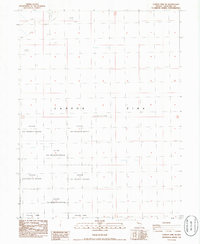
1986 Map of Carson Sink SE
USGS Topo · Published 1986About this map
Fallon Nat Wildlife Refuge dominates this mid-1980s terrain study of the high desert in Churchill County. This area is characterized by the expansive Carson Sink, a significant geological depression where the Carson River once terminated in an endorheic basin. The map reveals a landscape of environmental extremes, alternating between the protected habitat of the Fallon NWR and the desolate stretches of Alkali Flat. These features reflect the natural drainage patterns of the Great Basin, where evaporation leaves behind mineral-rich crusts across the sink. The grid system of townships and ranges, including T 23 N and T 22 N, provides the only human-imposed structure over this largely uninhabited wetland and desert complex.
Find a feature on this map
6 named features on this map. Tap any name to fly to it.
Don’t see what you’re looking for? This feature index may not catch every label — zoom into the map to look around manually.
Map Details
Editions of this 1986 Carson Sink SE Map
This is the sole edition of this map. No revisions or reprints were ever made.
Other maps of this area

1908 · Carson Sink
USGS Topo · 1:250,000

1910 · Carson Sink
USGS Topo · 1:250,000

1950 · Stillwater
USGS Topo · 1:62,500

1951 · Carson Sink
USGS Topo · 1:62,500

1957 · Reno
USGS Topo · 1:250,000

1959 · Reno
USGS Topo · 1:250,000

1960 · Reno
USGS Topo · 1:250,000
1969 · Lone Rock SW
USGS Topo · 1:24,000

1969 · Pintail Bay
USGS Topo · 1:24,000
1969 · Lone Rock NW
USGS Topo · 1:24,000