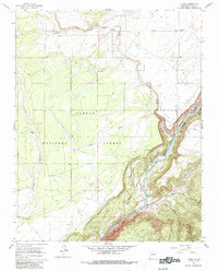
1961 Map of Carson
USGS Topo · Published 1985About this map
Carson National Forest dominates this high-altitude landscape where the sagebrush plains drop precipitously into the Rio Grande Gorge. The map captures a transition in early 1960s New Mexico, documenting small rural outposts like the Carson PO and the settlement of Pilar along the river banks. Water management in this arid environment is clearly legible through named infrastructure like Mondragon Tank, Clarkson Tank, and Barnett Well, which supported local ranching and early habitation. Along the southeastern edge, the deep incision of the Rio Grande del Norte is buffered by the Rio Grande State Park. The complex drainage network, including the Arroyo de la Petaca and Agua Caliente Canyon, defines the sharp topography of the region as it descends from the plateau toward the river bottom.
Find a feature on this map
21 named features on this map. Tap any name to fly to it.
Don’t see what you’re looking for? This feature index may not catch every label — zoom into the map to look around manually.
Map Details
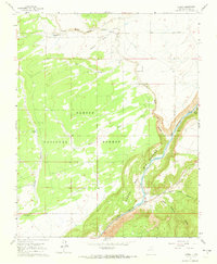
Editions of this 1961 Carson Map
3 editions found
Other maps of this area

1953 · Velarde
USGS Topo · 1:24,000

1953 · Trampas
USGS Topo · 1:24,000

1954 · Raton
USGS Topo · 1:250,000

1958 · Raton
USGS Topo · 1:250,000

1960 · Taos Junction
USGS Topo · 1:24,000

1961 · Carson
USGS Topo · 1:24,000

1961 · Tres Orejas
USGS Topo · 1:24,000

1961 · Servilleta Plaza
USGS Topo · 1:24,000

1964 · Los Cordovas
USGS Topo · 1:24,000

1964 · Penasco
USGS Topo · 1:24,000