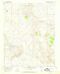
1966 Map of Carson Trading Post
USGS Topo · Published 1969About this map
The Bisti Oil Field dominates the arid landscape of San Juan County in the mid-1960s, evidenced by a network of pipelines and scattered oil wells across the high desert terrain. This era of industrial development is captured alongside established local landmarks like the Carson Trading Post and the nearby Huerfano Reservation Dormitory.
Find a feature on this map
12 named features on this map. Tap any name to fly to it.
Don’t see what you’re looking for? This feature index may not catch every label — zoom into the map to look around manually.
Map Details
Editions of this 1966 Carson Trading Post Map
2 editions found
Other maps of this area

1889 · Largo
USGS Topo · 1:250,000

1889 · Chaco
USGS Topo · 1:250,000

1892 · Chaco
USGS Topo · 1:250,000

1895 · Largo
USGS Topo · 1:250,000

1954 · Shiprock
USGS Topo · 1:250,000

1954 · Aztec
USGS Topo · 1:250,000

1958 · Shiprock
USGS Topo · 1:250,000

1958 · Aztec
USGS Topo · 1:250,000

1959 · Shiprock
USGS Topo · 1:250,000

1960 · Bloomfield
USGS Topo · 1:62,500