1938 Map of Carter
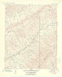
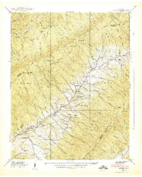
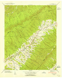
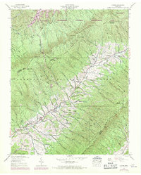
USGS Topo · Published 1954About this map
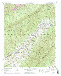
Stony Creek flows through a narrow valley floor, serving as the primary corridor for settlement and transportation in this pre-war survey. The community of Carter and the neighboring hamlet of Winner anchor the southwestern portion of the valley, while Buladeen sits further upstream to the northeast. This area of eastern Tennessee is defined by the proximity of Holston Mountain and Iron Mountain, with the Appalachian Trail following the high ridges.
Find a feature on this map
126 named features on this map. Tap any name to fly to it.
Don’t see what you’re looking for? This feature index may not catch every label — zoom into the map to look around manually.
Map Details
Editions of this 1938 Carter Map
5 editions found
Other maps of this area

1891 · Roan Mountain
USGS Topo · 1:125,000

1891 · Abingdon
USGS Topo · 1:125,000

1893 · Cranberry
USGS Topo · 1:125,000

1894 · Roan Mountain
USGS Topo · 1:125,000

1894 · Abingdon
USGS Topo · 1:125,000

1895 · Cranberry
USGS Topo · 1:125,000

1897 · Bristol
USGS Topo · 1:125,000

1899 · Cranberry
USGS Topo · 1:125,000

1902 · Bristol
USGS Topo · 1:125,000

1902 · Cranberry
USGS Topo · 1:125,000