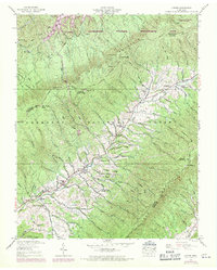
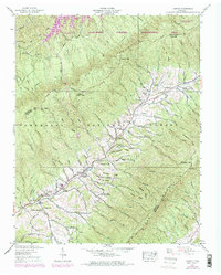
1938 Map of Carter
USGS Topo · Published 1970About this map
Holston Mountain and the Iron Mountains dominate this landscape on the border of Sullivan and Carter Counties. The 1938 fieldwork, updated with 1969 aerial data, shows a region defined by steep ridges and narrow hollows where settlements like Buladeen and Carter are tucked along the winding path of Stony Creek. The map records a rural social fabric of small schoolhouses and country churches, including Midway Sch and Holly Springs Ch. Industry is represented by the Stoutson Quarry and evidence of previous activity at Strip Mine Ridge. As the terrain rises toward Holston High Knob, the vast acreage of the Cherokee National Forest and the Kettlefoot Wildlife Management Area illustrate the transition from valley agriculture to protected mountain wilderness, while the presence of South Holston Lake in the northwest corner marks the impact of TVA water management.
Find a feature on this map
98 named features on this map. Tap any name to fly to it.
Don’t see what you’re looking for? This feature index may not catch every label — zoom into the map to look around manually.
Map Details
Editions of this 1938 Carter Map
5 editions found
Other maps of this area

1891 · Roan Mountain
USGS Topo · 1:125,000

1891 · Abingdon
USGS Topo · 1:125,000

1893 · Cranberry
USGS Topo · 1:125,000

1894 · Roan Mountain
USGS Topo · 1:125,000

1894 · Abingdon
USGS Topo · 1:125,000

1895 · Cranberry
USGS Topo · 1:125,000

1897 · Bristol
USGS Topo · 1:125,000

1899 · Cranberry
USGS Topo · 1:125,000

1902 · Bristol
USGS Topo · 1:125,000

1902 · Cranberry
USGS Topo · 1:125,000