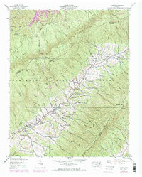
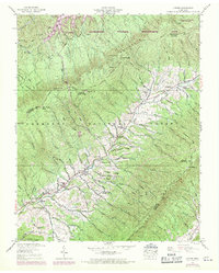
1938 Map of Carter
USGS Topo · Published 1970About this map
Stony Creek winds through the heart of this landscape, anchoring small settlements like Winner and Buladeen during a period of transition for the rural Tennessee highlands. The map shows the region as it was field checked by the Tennessee Valley Authority in 1938, with purple 1969 revisions illustrating subsequent changes to roads and field lines. Community life is centered around local institutions such as Caldwell Springs Ch, Winner Sch, and Unaka Sch.
Find a feature on this map
111 named features on this map. Tap any name to fly to it.
Don’t see what you’re looking for? This feature index may not catch every label — zoom into the map to look around manually.
Map Details
Editions of this 1938 Carter Map
5 editions found
Other maps of this area

1891 · Roan Mountain
USGS Topo · 1:125,000

1891 · Abingdon
USGS Topo · 1:125,000

1893 · Cranberry
USGS Topo · 1:125,000

1894 · Roan Mountain
USGS Topo · 1:125,000

1894 · Abingdon
USGS Topo · 1:125,000

1895 · Cranberry
USGS Topo · 1:125,000

1897 · Bristol
USGS Topo · 1:125,000

1899 · Cranberry
USGS Topo · 1:125,000

1902 · Bristol
USGS Topo · 1:125,000

1902 · Cranberry
USGS Topo · 1:125,000