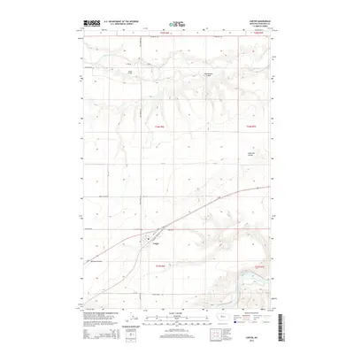
2014 Map of Carter
USGS Topo · Published 2014About this map
Carter serves as a focal point in this Chouteau County landscape, positioned along Us-87 and Mountain View Rd. The settlement patterns here are deeply influenced by the area's hydrology and historical transit routes, with the Teton River cutting across the northern sections and the Missouri River appearing in the southeast. Historical infrastructure is well-marked, including the Carter Cem and traces of the regional history found in labels like Whoop Up Trl and Carter Ferry Rd. The geography is defined by significant coulees such as Weatherwax Coulee and Eightmile Coulee, which create distinct drainage patterns toward the larger river basins. Roadways like Davis School Rd and Buck Bridge Rd provide a clear grid for tracing local land ownership and the placement of former rural institutions in the early 21st century.
Find a feature on this map
32 named features on this map. Tap any name to fly to it.
Don’t see what you’re looking for? This feature index may not catch every label — zoom into the map to look around manually.
Map Details
Editions of this 2014 Carter Map
This is the sole edition of this map. No revisions or reprints were ever made.
Other maps of this area

1886 · Great Falls
USGS Topo · 1:250,000

1890 · Fort Benton
USGS Topo · 1:250,000

1892 · Fort Benton
USGS Topo · 1:250,000

1897 · Fort Benton
USGS Topo · 1:250,000

1948 · Portage
USGS Topo · 1:62,500

1949 · Portage
USGS Topo · 1:62,500

1950 · Dent Bridge
USGS Topo · 1:62,500

1953 · Carter
USGS Topo · 1:24,000

1953 · Tunis
USGS Topo · 1:24,000

1954 · Great Falls
USGS Topo · 1:250,000