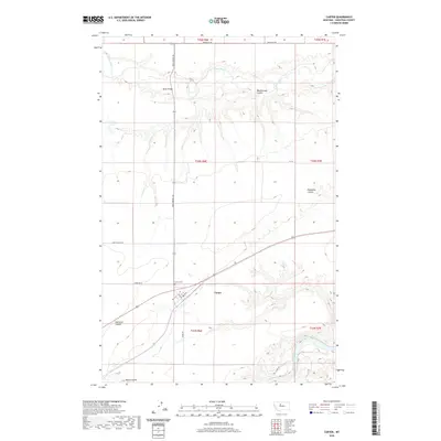
2020 Map of Carter
USGS Topo · Published 2020About this map
The small town of Carter serves as the central hub of this Chouteau County landscape, situated near the Carter Cem and a grid of rural routes like Davis School Rd. The map reveals a high plains terrain deeply incised by drainage features, most notably the winding paths of the Teton River to the north and a small portion of the Missouri River in the southeast corner. The topography is defined by significant coulees including Weatherwax Coulee, Eightmile Coulee, and Bullhead Coulee, which dictate the local movement and land use patterns.
Find a feature on this map
23 named features on this map. Tap any name to fly to it.
Don’t see what you’re looking for? This feature index may not catch every label — zoom into the map to look around manually.
Map Details
Editions of this 2020 Carter Map
This is the sole edition of this map. No revisions or reprints were ever made.
Other maps of this area

1886 · Great Falls
USGS Topo · 1:250,000

1890 · Fort Benton
USGS Topo · 1:250,000

1892 · Fort Benton
USGS Topo · 1:250,000

1897 · Fort Benton
USGS Topo · 1:250,000

1948 · Portage
USGS Topo · 1:62,500

1949 · Portage
USGS Topo · 1:62,500

1950 · Dent Bridge
USGS Topo · 1:62,500

1953 · Carter
USGS Topo · 1:24,000

1953 · Tunis
USGS Topo · 1:24,000

1954 · Great Falls
USGS Topo · 1:250,000