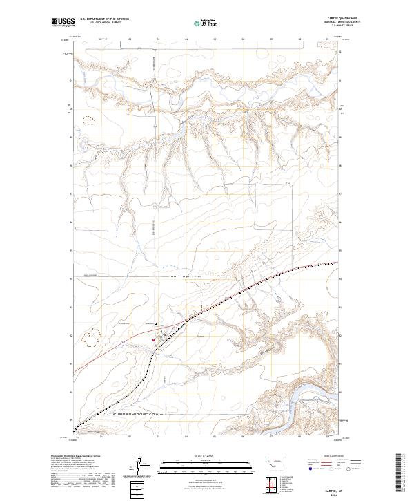
2024 Map of Carter
USGS Topo · Published 2024About this map
Carter serves as the central settlement in this agricultural landscape of Chouteau County, where the plains are deeply dissected by water-carved coulees. The town's grid, including Main and 3rd Ave, sits just north of the winding Bullhead Coulee. To the north, the Teton River meanders through a broad valley floor, while the Missouri River cuts through the southeastern corner of the quadrangle. The map captures a transition between traditional overland routes and modern infrastructure, evidenced by the historical path of the Whoop Up Trl crossing the northern sections. Local landmarks such as the Carter Cem and Davis School Rd provide specific points of interest for genealogists tracing family footprints in this rural district. The drainage patterns of Weatherwax Coulee and Black Coulee define the local topography, shaping the roads that connect remote homesteads to the rail-aligned core of Carter.
Find a feature on this map
22 named features on this map. Tap any name to fly to it.
Don’t see what you’re looking for? This feature index may not catch every label — zoom into the map to look around manually.
Map Details
Editions of this 2024 Carter Map
This is the sole edition of this map. No revisions or reprints were ever made.
Other maps of this area

1886 · Great Falls
USGS Topo · 1:250,000

1890 · Fort Benton
USGS Topo · 1:250,000

1892 · Fort Benton
USGS Topo · 1:250,000

1897 · Fort Benton
USGS Topo · 1:250,000

1948 · Portage
USGS Topo · 1:62,500

1949 · Portage
USGS Topo · 1:62,500

1950 · Dent Bridge
USGS Topo · 1:62,500

1953 · Carter
USGS Topo · 1:24,000

1953 · Tunis
USGS Topo · 1:24,000

1954 · Great Falls
USGS Topo · 1:250,000