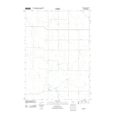
2012 Map of Carter
USGS Topo · Published 2012About this map
Carter serves as the central hub of this South Dakota landscape, positioned along the southern edge of the sheet where Filmore St anchors the small grid of streets. The surrounding terrain is defined by a network of seasonal watercourses including McChesneys Cr, Two Nation Cr, and De Bell Cr. These drainages carve through the prairie landscape, punctuated by the localized rise of the Red Hills.
Find a feature on this map
17 named features on this map. Tap any name to fly to it.
Don’t see what you’re looking for? This feature index may not catch every label — zoom into the map to look around manually.
Map Details
Editions of this 2012 Carter Map
This is the sole edition of this map. No revisions or reprints were ever made.
Other maps of this area

1955 · Martin
USGS Topo · 1:250,000

1958 · Martin
USGS Topo · 1:250,000

1982 · Presho 4 SE
USGS Topo · 1:25,000

1982 · Witten SE
USGS Topo · 1:25,000

1982 · Two Nation Creek
USGS Topo · 1:25,000

1982 · Badnation SE
USGS Topo · 1:25,000

1982 · Witten
USGS Topo · 1:25,000

1982 · Witten SW
USGS Topo · 1:25,000

1982 · Okreek SE
USGS Topo · 1:24,000
1982 · Carter
USGS Topo · 1:25,000