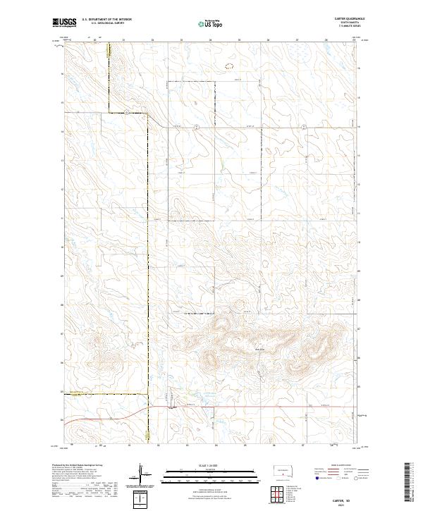
2021 Map of Carter
USGS Topo · Published 2021About this map
Carter sits at a critical junction in southern South Dakota, positioned where the boundaries of Mellette, Todd, and Tripp counties converge. This sparsely populated agricultural landscape is defined by the winding paths of several watercourses, including McChesneys Cr, Two Nation Cr, and De Bell Cr. The terrain shifts from open plains in the north to the more complex topography of the Red Hills in the southeast, providing a clear view of the area's natural drainage patterns. The local infrastructure is anchored by a grid of section-line roads such as 297th Ave and 277th St, which facilitate movement between rural homesteads and the Carter Dam Reservoir. This survey documents a quiet prairie community where township and range lines remain the primary organizational force for land and life.
Find a feature on this map
28 named features on this map. Tap any name to fly to it.
Don’t see what you’re looking for? This feature index may not catch every label — zoom into the map to look around manually.
Map Details
Editions of this 2021 Carter Map
This is the sole edition of this map. No revisions or reprints were ever made.
Other maps of this area

1955 · Martin
USGS Topo · 1:250,000

1958 · Martin
USGS Topo · 1:250,000

1982 · Presho 4 SE
USGS Topo · 1:25,000

1982 · Witten SE
USGS Topo · 1:25,000

1982 · Two Nation Creek
USGS Topo · 1:25,000

1982 · Badnation SE
USGS Topo · 1:25,000

1982 · Witten
USGS Topo · 1:25,000

1982 · Witten SW
USGS Topo · 1:25,000

1982 · Okreek SE
USGS Topo · 1:24,000
1982 · Carter
USGS Topo · 1:25,000