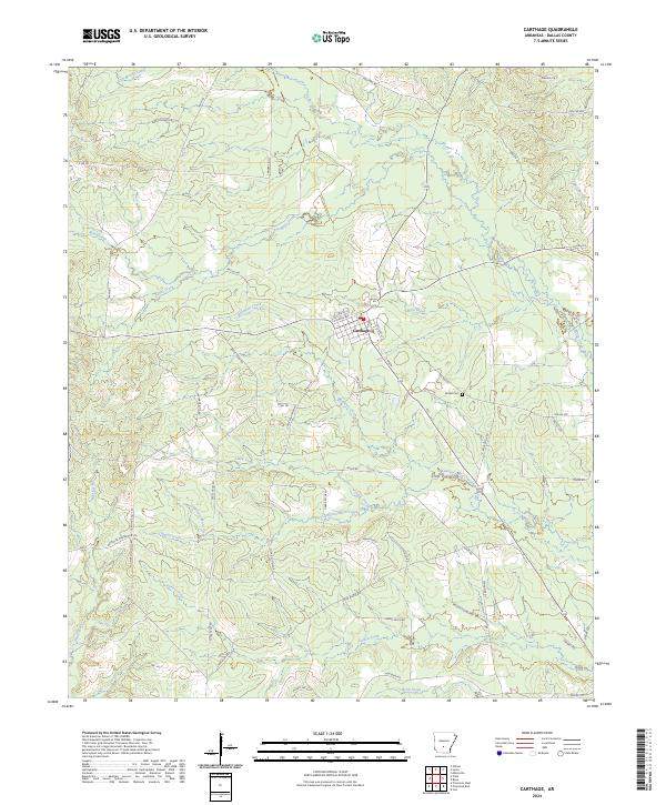
2024 Map of Carthage
USGS Topo · Published 2024About this map
Carthage serves as the central hub for this portion of Dallas County, where a grid of local streets including W Church St and S Main marks the small town center. The landscape is defined by an intricate network of waterways, primarily the winding path of Moro Creek and its many tributaries like Lawrence Moro Creek and Dyer Moro Creek. These streams create a complex drainage pattern through the low-lying terrain, flanked by numerous timber roads and trails such as Eagle Tram Rd and Tram Trl, which hint at the region's long-standing connection to the logging industry. To the southeast of the town center, Bethel Cem stands as a quiet marker of local history near the junction of Matthews Creek and several rural routes. The presence of a Po in Carthage anchors the community, while the surrounding area remains largely dominated by the natural flow of creeks like Tenmile Creek and Gum Creek.
Find a feature on this map
60 named features on this map. Tap any name to fly to it.
Don’t see what you’re looking for? This feature index may not catch every label — zoom into the map to look around manually.
Map Details
Editions of this 2024 Carthage Map
This is the sole edition of this map. No revisions or reprints were ever made.
Other maps of this area

1903 · Camden
USGS Topo · 1:125,000

1953 · El Dorado
USGS Topo · 1:250,000

1955 · Little Rock
USGS Topo · 1:250,000

1956 · Little Rock
USGS Topo · 1:250,000

1957 · El Dorado
USGS Topo · 1:250,000

1958 · El Dorado
USGS Topo · 1:250,000

1960 · El Dorado
USGS Topo · 1:250,000

1960 · Little Rock
USGS Topo · 1:250,000

1964 · Little Rock
USGS Topo · 1:250,000

1964 · Bunn
USGS Topo · 1:24,000