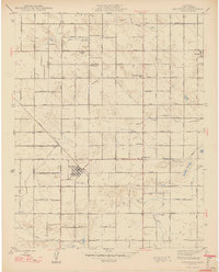
1947 Map of Caruthers
USGS Topo · Published 1947About this map
Caruthers sits at the heart of this grid of agricultural development in Fresno County, where a meticulous network of irrigation ditches and canals defined the landscape following the mid-century. The map, overseen by State Engineer Edward Hyatt and Governor Earl Warren, illustrates a highly organized rural society centered on community education and faith. A notable string of rural schoolhouses, including University Colony Sch, Alvina Sch, and Princeton Sch, are spaced regularly along the section lines, serving the farming families of the San Joaquin Valley. Irrigation is the lifeblood of the region, visible through features like the Wristen Canal and Davis Ditch. Near the northern border, the small settlement of Bowles is marked by its rail siding and the Bowles Ch, providing a clear record of local infrastructure before modern consolidation changed the rural school system.
Find a feature on this map
31 named features on this map. Tap any name to fly to it.
Don’t see what you’re looking for? This feature index may not catch every label — zoom into the map to look around manually.
Map Details
Editions of this 1947 Caruthers Map
2 editions found
Other maps of this area

1923 · Kearney Park
USGS Topo · 1:31,680

1923 · Malaga
USGS Topo · 1:31,680

1923 · Fresno
USGS Topo · 1:31,680

1924 · Riverdale
USGS Topo · 1:31,680

1924 · Conejo
USGS Topo · 1:31,680

1925 · Raisin
USGS Topo · 1:31,680

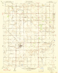
1925 · Caruthers
USGS Topo · 1:31,680

1927 · Laton
USGS Topo · 1:31,680

1927 · Burrel
USGS Topo · 1:31,680

1927 · Riverdale
USGS Topo · 1:31,680