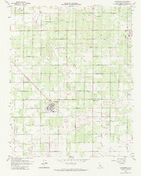
1963 Map of Caruthers
USGS Topo · Published 1964About this map
Caruthers serves as the hub of this Central Valley agricultural landscape in the early 1960s, its street grid oriented diagonally against the surrounding square-mile section lines. The town’s social fabric is anchored by landmarks like the Union Sch and Clemenceau Ave, while the surrounding countryside is defined by an intensive network of irrigation channels including the unnamed Canal, Aqueduct, and Ditch features that supported the region's productive vineyards and orchards.
Find a feature on this map
51 named features on this map. Tap any name to fly to it.
Don’t see what you’re looking for? This feature index may not catch every label — zoom into the map to look around manually.
Map Details
Editions of this 1963 Caruthers Map
2 editions found
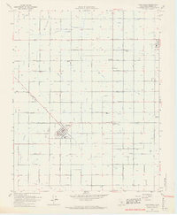
Other maps of this area

1923 · Kearney Park
USGS Topo · 1:31,680

1923 · Malaga
USGS Topo · 1:31,680

1923 · Fresno
USGS Topo · 1:31,680

1924 · Riverdale
USGS Topo · 1:31,680

1924 · Conejo
USGS Topo · 1:31,680

1925 · Raisin
USGS Topo · 1:31,680

1925 · Caruthers
USGS Topo · 1:31,680

1927 · Laton
USGS Topo · 1:31,680

1927 · Burrel
USGS Topo · 1:31,680

1927 · Riverdale
USGS Topo · 1:31,680