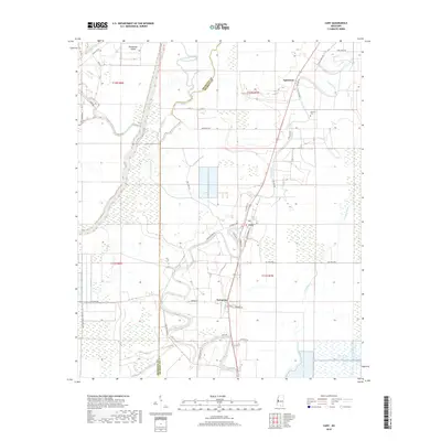
2018 Map of Cary
USGS Topo · Published 2018About this map
The town of Cary serves as the central hub of this Sharkey County landscape, where the alluvial plain of the Mississippi Delta is defined by an intricate network of slow-moving waterways. Winding through the territory, Deer Creek and Steele Bayou dictate the placement of local infrastructure, with the primary rail and road corridor following the high ground alongside the creek. To the north, the small community of Egremont sits near Danover Cem, while the settlement of Issaquena occupies the southern reaches of the quadrangle. The map reveals a land heavily influenced by its hydrology, showing features like Poindexter Island and Coon Bayou amidst a grid of agricultural service roads such as Cary Blanton Rd and Owl Hoot Rd. This modern survey documents the persistent relationship between the region's agricultural economy and its deltaic environment.
Find a feature on this map
42 named features on this map. Tap any name to fly to it.
Don’t see what you’re looking for? This feature index may not catch every label — zoom into the map to look around manually.
Map Details
Editions of this 2018 Cary Map
This is the sole edition of this map. No revisions or reprints were ever made.
Other maps of this area

1909 · Wilsons Point
USGS Topo · 1:24,000

1913 · Wilson Point
USGS Topo · 1:31,680

1939 · Onward
USGS Topo · 1:62,500

1939 · Lorenzen
USGS Topo · 1:62,500

1939 · Alsatia
USGS Topo · 1:62,500

1939 · Mayersville
USGS Topo · 1:62,500

1955 · Jackson
USGS Topo · 1:250,000

1961 · Jackson
USGS Topo · 1:250,000

1962 · Jackson
USGS Topo · 1:250,000

1963 · Onward
USGS Topo · 1:62,500