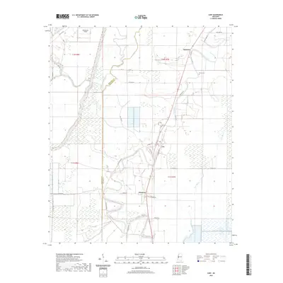
2020 Map of Cary
USGS Topo · Published 2020About this map
Deer Creek meanders through the alluvial landscape of the Mississippi Delta, anchoring the small settlements of Cary and Issaquena in this modern survey of the region. The map reveals the intricate network of watercourses and bayous that define the local topography, including Steele Bayou and Coon Bayou. The layout of the town of Cary is clearly delineated with local streets such as Magnolia Dr and Willow Ln, while the rural surroundings are marked by land divisions and irrigation patterns common to Sharkey and Issaquena counties. Genealogists and local historians can locate the Danover Cem east of Egremont, as well as significant landmarks like Poindexter Island. The presence of Oil Well Rd points toward the industrial activity and resource extraction that continues to shape the economic character of the Delta's flatlands.
Find a feature on this map
43 named features on this map. Tap any name to fly to it.
Don’t see what you’re looking for? This feature index may not catch every label — zoom into the map to look around manually.
Map Details
Editions of this 2020 Cary Map
This is the sole edition of this map. No revisions or reprints were ever made.
Other maps of this area

1909 · Wilsons Point
USGS Topo · 1:24,000

1913 · Wilson Point
USGS Topo · 1:31,680

1939 · Onward
USGS Topo · 1:62,500

1939 · Lorenzen
USGS Topo · 1:62,500

1939 · Alsatia
USGS Topo · 1:62,500

1939 · Mayersville
USGS Topo · 1:62,500

1955 · Jackson
USGS Topo · 1:250,000

1961 · Jackson
USGS Topo · 1:250,000

1962 · Jackson
USGS Topo · 1:250,000

1963 · Onward
USGS Topo · 1:62,500