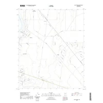
2020 Map of Casa Colorada
USGS Topo · Published 2020About this map
Rio Communities occupies the northern reach of this landscape, where the high desert terrain of the Rio Grande valley meets planned residential development. The map details the transition from the fertile corridor of the Rio Grande into the arid uplands, marked by the prominent drainage of the Abo Arroyo as it cuts toward the Valencia County and Socorro County line. Modern infrastructure is characterized by an extensive network of residential loops and avenues, including Rio Communities Blvd and the sprawling Navajo Loop. Localities like Madrone, Bodega, and the eponymous Casa Colorada appear as distinct nodes within this network, reflecting the 21st-century growth patterns of the Middle Rio Grande Valley. The cartography provides a clear look at how property divisions and local roads like Ensayo Loop and Turbine Rd have shaped the land between the river and the eastern mesas.
Find a feature on this map
61 named features on this map. Tap any name to fly to it.
Don’t see what you’re looking for? This feature index may not catch every label — zoom into the map to look around manually.
Map Details
Editions of this 2020 Casa Colorada Map
This is the sole edition of this map. No revisions or reprints were ever made.
Other maps of this area

1916 · La Joya
USGS Topo · 1:125,000

1952 · Tome SE
USGS Topo · 1:24,000

1952 · Black Butte
USGS Topo · 1:24,000

1952 · Tome NE
USGS Topo · 1:24,000

1952 · Belen
USGS Topo · 1:24,000

1952 · Turn
USGS Topo · 1:24,000

1952 · Veguita
USGS Topo · 1:24,000

1952 · Tome
USGS Topo · 1:24,000

1952 · Becker
USGS Topo · 1:24,000

1952 · Abeytas
USGS Topo · 1:24,000