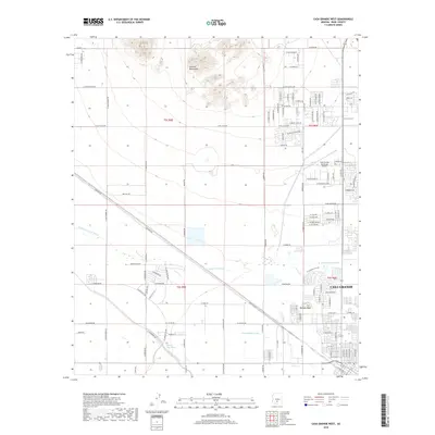
2018 Map of Casa Grande West
USGS Topo · Published 2018About this map
Casa Grande serves as the primary urban anchor on this 2018 survey, with residential streets and public infrastructure concentrated in the southeast quadrant. The landscape is defined by the contrast between organized agricultural and residential grids and the natural relief of the Sacaton Mountains to the north. Water management is central to the area's geography, visible through the course of the Casa Grande Canal and the meandering paths of the Santa Cruz Wash and its northern branch. The Casa Grande Municipal Airport occupies a significant tract north of the town center, while Burgess Peak provides a prominent natural landmark amidst the flat valley floor. Long-standing thoroughfares like Cowtown Rd and W Main St underscore the region's development as a transportation and irrigation hub in Pinal County.
Find a feature on this map
56 named features on this map. Tap any name to fly to it.
Don’t see what you’re looking for? This feature index may not catch every label — zoom into the map to look around manually.
Map Details
Editions of this 2018 Casa Grande West Map
This is the sole edition of this map. No revisions or reprints were ever made.
Other maps of this area

1907 · Sacaton
USGS Topo · 1:62,500

1914 · Gila Butte
USGS Topo · 1:62,500

1917 · Gila Butte
USGS Topo · 1:62,500

1922 · Casa Grande
USGS Topo · 1:62,500

1922 · Signal Peak
USGS Topo · 1:62,500

1924 · Signal Peak
USGS Topo · 1:62,500

1924 · Casa Grande
USGS Topo · 1:62,500

1952 · Gila Butte SE
USGS Topo · 1:24,000

1952 · Sacaton Butte
USGS Topo · 1:24,000

1952 · Gila Butte
USGS Topo · 1:62,500