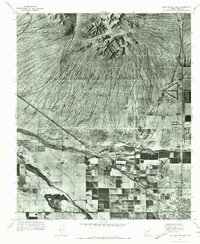
1971 Map of Casa Grande West
USGS Topo · Published 1972About this map
Sacaton Mountains dominate the northern landscape of this orthophotomap, showing the stark transition from the high relief of the peaks to the alluvial fans below. By the early 1970s, the southern portion of the quadrangle shows significant agricultural development, characterized by a geometric grid of fields and irrigation infrastructure that contrasts sharply with the untamed desert terrain to the north. The drainage patterns of the North Branch Santa Cruz Wash and the main Santa Cruz Wash are clearly visible, tracing the natural path of water through the arid valley. In the southeast corner, the outskirts of Casa Grande begin to emerge, marking the encroachment of urban settlement into the surrounding farmland and desert during this period of Arizona's growth.
Find a feature on this map
4 named features on this map. Tap any name to fly to it.
Don’t see what you’re looking for? This feature index may not catch every label — zoom into the map to look around manually.
Map Details
Editions of this 1971 Casa Grande West Map
This is the sole edition of this map. No revisions or reprints were ever made.
Other maps of this area

1907 · Sacaton
USGS Topo · 1:62,500

1914 · Gila Butte
USGS Topo · 1:62,500

1917 · Gila Butte
USGS Topo · 1:62,500

1922 · Casa Grande
USGS Topo · 1:62,500

1922 · Signal Peak
USGS Topo · 1:62,500

1924 · Signal Peak
USGS Topo · 1:62,500

1924 · Casa Grande
USGS Topo · 1:62,500

1952 · Gila Butte SE
USGS Topo · 1:24,000

1952 · Sacaton Butte
USGS Topo · 1:24,000

1952 · Gila Butte
USGS Topo · 1:62,500